Surveying Services for Builders
Axis Surveys are specialist Consulting Surveyors to the residential building industry. We provide a comprehensive range of Surveying services to the building industry, with brief descriptions of our most common surveys for Builders listed below, so you can order the right survey for your particular job site.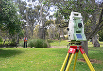
Contour and Detail Surveys
Give a true representation of the shape, features and services of a site. They normally include manmade improvements, trees and natural features, and if required adjoining property information. They are the basis of house and building design, and assist in determining “Ground Level”.
House Set Out
From approved building plans we calculate and setout as many corners of the new structure as required and supply a certificate confirming that the new structure has been set out in the correct position in relation to the property boundaries.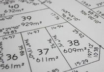
Boundary Survey Work
Remarking or offsetting of existing property boundaries in QLD requires by law that a formal Identification Survey Plan of the survey work undertaken be prepared and lodged with the Dept of Natural Resources & Mines. Identification Surveys are more common in older areas and when building on or near the boundaries, with cost depending on the age of the property, the size, the location and the characteristics of a particular site and also its proximity to more recent survey work.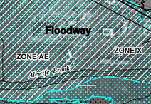
Australian Height Datum (AHD) & Flood Level Plans
AHD is in simple terms, the height of a particular spot above sea level. It can be determined by levelling from known Permanent Survey Marks (PSM’s), or by GPS or GNSS observation. AHD is critical in flood prone or drainage problem areas, or when needing to connect into services such as sewer or stormwater , or when determining “Ground Level” for house design purposes. With a known flood level we can mark the level on the ground or prepare a suitable plan showing the extent of flooding on a site.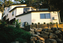
Height Certificates & “Ground Level” Definition
Height Certificates are normally done to confirm the height of floor slabs or roof heights relative to AHD or relative to the Local Council’s definition of “Ground Level”. Determining “Ground Level” is a process that must be undertaken by a Consulting Cadastral Surveyor and should be determined before any design or construction work is commenced as most local authorities have limitations on how high a building can be constructed.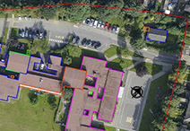
Location Certificate
This service involves locating an existing structure or feature in relation to the property boundaries and preparing and certifying a suitable plan to accompany the location certificate.
Building & Civil Construction Setout
Both these types of surveys are carried out on a larger scale than a house setout, and involves setting up survey control and often make use of gridlines, and require ongoing interaction with qualified technical staff, before and during the project. We have specific staff to look after these more demanding jobs and they would normally be your one point of contact for the life of the project.Ready to Order?
To order any of our services, or to make an enquiry, please call us or send an email.
 Send an email